Geospatial analysis
Spatial questions, traceable methods, and maps that make the findings clear.
- ArcGIS Pro & ArcGIS Online
- Geodatabases & spatial QA/QC
- Network Analyst & location-allocation
- Cartography & spatial statistics

Geospatial analyst & urban planner
My work sits at the intersection of geospatial analysis, infrastructure, and urban planning. From field observations to spatial models and interactive maps, I care about making information reliable, understandable, and useful to the people making decisions.
I bring graduate training in both GIS and urban planning, professional experience in infrastructure and consulting, and university research and teaching experience across Texas, Alabama, and Hawaiʻi. My projects explore environmental resilience, accessibility, remote sensing, and the everyday systems that connect communities.
Connecting data, places & people.
Careful data, clear methods, and tools people can use.
Spatial questions, traceable methods, and maps that make the findings clear.
Connecting field observations with reliable asset information and useful applications.
Bringing terrain, imagery, and community context into the same analysis.
My current work connects pipeline integrity, field collection, dashboards, and reliable asset records—turning source information into tools teams can use.
Explore my professional workContribute GIS models, verified pipeline and inspection records, and risk documentation to distribution and transmission integrity management.
DIMP / TIMP · ArcGIS Pro
Bring pressure-test status, pipeline locations, supporting documents, and coordinated filters together in one place for operational review.
ArcGIS Dashboards · Arcade
Build structured field forms that retrieve pipeline details from barcode lookups, with photo-based evidence when scanning or matching is unavailable.
Survey123 Connect · Field Maps
Connect forms, hosted layers, and mapped views in applications that help teams request imagery and review infrastructure information.
Experience Builder · ArcGIS Enterprise
Prepare spatial integrity analyses and maintain segment-level risk inputs, connecting pipeline data with environmental and consequence information.
Spatial analysis · Risk-model review
Maintain pipeline and service-line datasets, reconcile work orders with mapped mains, and connect assets to the documents that support them.
Geodatabases · QA/QC & attachments
Infrastructure practice, university research, teaching, and planning.
View the full résuméCentric Infrastructure Group
Aug 25, 2025 - Present | The Woodlands, Texas | Promoted from GIS Intern.
Previous role: GIS Intern | Jun 2, 2025 - Aug 23, 2025
Part-time university appointment
Part-time research appointment
Part-time research appointment
Project appointment
Business Development and Planning Department
Environmental research, better access, and the infrastructure that supports communities.
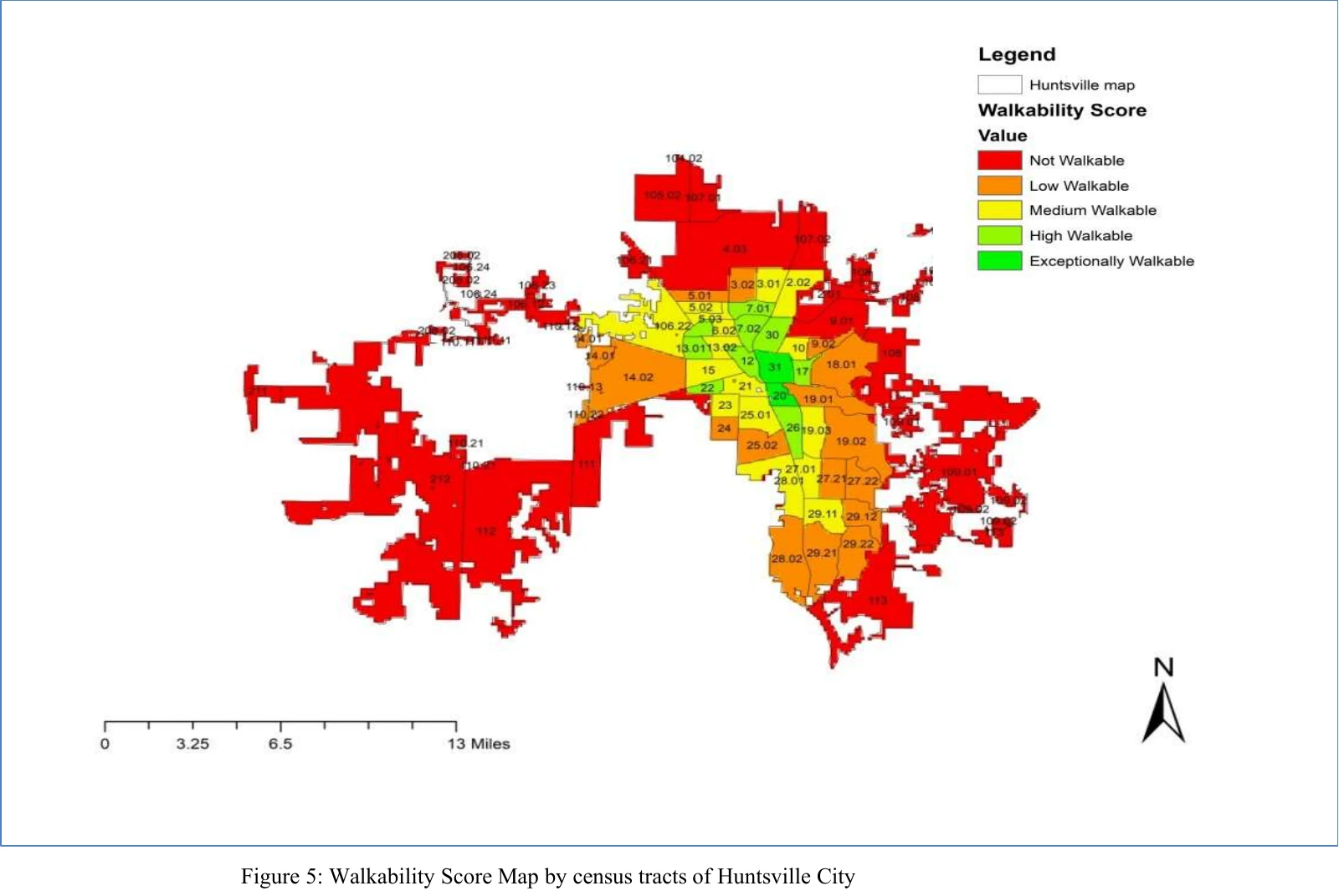
Explore all projectsA GIS-based Walkable Service Area Analysis model across 64 census tracts.
Network Analyst · Service areas · Accessibility
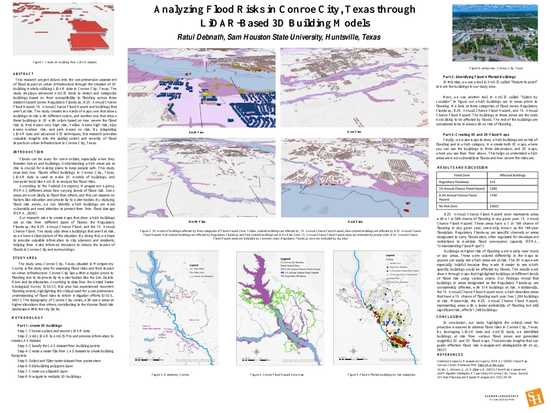
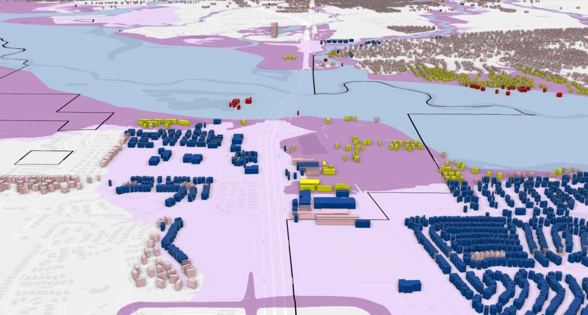
Explore the case studyCombining LiDAR-derived buildings and mapped flood zones to make structural exposure visible.
ArcGIS Pro · LiDAR · 3D GIS
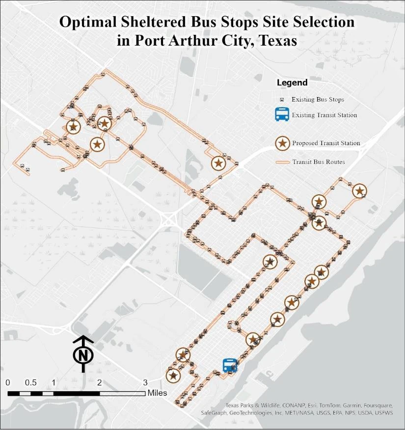
Explore the case studyUsing network analysis to evaluate sheltered bus-stop locations and population coverage.
Network Analyst · Location-allocation · Demographics
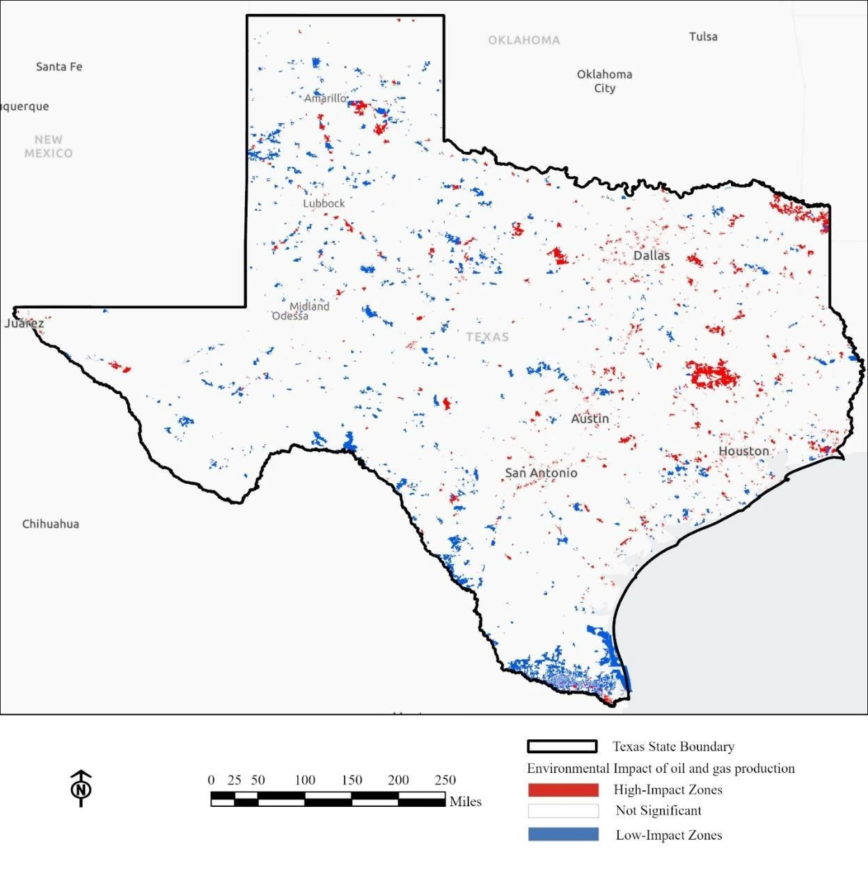
Explore the case studyWeighted overlay and spatial statistics connecting hydrography, land cover, and population.
Weighted overlay · Hot spot analysis · Zonal statistics
Explore the case studyFour academic projects · A new project every 5 seconds. Pause to explore at your own pace.
8 publications on geospatial methods, infrastructure resilience, environmental sensing, and applied research.
View my Google Scholar profile (opens in a new tab)Journal of Sustainable Development and Policy
Read publicationAmerican Journal of Advanced Technology and Engineering Solutions
Read publicationAmerican Journal of Data Science and Analytics · 7 (06), 507-544
Read publicationASRC Procedia: Global Perspectives in Science and Scholarship · 1 (01), 1603-1635
Read publicationInternational Journal of Scientific Interdisciplinary Research · 4 (3), 153-188
Read publicationInternational Journal of Scientific Advances
Read publicationAmerican Journal of Interdisciplinary Studies · 3 (04), 332-364
Read publicationReview of Applied Science and Technology · 1 (03), 100-148
Read publication5 presentations on mobility, walkability, transportation modeling, and neighborhood planning.
24th Annual FEMA Emergency Management Higher Education Symposium
Symposium dates · National Emergency Training Center, Emmitsburg, Maryland
Presented research on changes in mobility across six activity categories in Hawaiʻi during COVID-19. The study used Google Community Mobility Reports and local polynomial regression to examine patterns from February 2020 through February 2022.
The original PDF includes the poster with Ratul Debnath’s name and University of Hawaiʻi at Mānoa affiliation on page 1, followed by a photograph at the 2022 symposium on page 2.
PSR Emerging Scholars Transportation Research Symposium
University of Southern California · Hybrid symposium
Examined pandemic-related changes in mobility and traffic safety in Hawaiʻi using Google mobility data and crash records from state Highway Safety Plan reports. Shared this research in the Disaster and Pandemic Preparedness in Hawaiʻi panel.
The program lists Ratul Debnath as a student speaker on page 2 and includes the presentation abstract, photograph, and University of Hawaiʻi at Mānoa affiliation on page 7.
Alabama–Mississippi Chapters of the American Planning Association Joint Virtual Conference
Daycap (Student Poster Presentations) · Virtual conference
Presented a trip-generation modeling study for travel-demand estimation in Madison County, Alabama, in the conference’s student research session.
The session page lists Ratul Debnath, Alabama A&M University, supervisor Dr. Jacob Oluwoye, and the full research title in its student-presenter table.
National Association of African American Studies & Affiliates National Conference
NAAAS · Scheduled paper presentation
Presented research on GIS-based assessment of walkable access and spatial equity in Huntsville.
The organizer’s letter, dated October 24, 2019, accepts this paper and schedules a 25-minute presentation for February 21, 2020 at 2:00 PM.
National Association of African American Studies & Affiliates National Conference
NAAAS · Poster session scheduled for 3:00–5:00 PM
A poster presentation of a graduate team project on neighborhood traffic management and pedestrian-oriented planning.
The organizer’s letter, dated November 26, 2019, accepts the Edmonton Height paper for a poster presentation and schedules it for February 20, 2020, from 3:00 to 5:00 PM.
Student volunteer · June 6–9, 2022
Supported registration, shared logistical information, participated in breakout sessions, assisted with plenary Q&A, and supported the Higher Education Program team.
Volunteer service recognition
FEMA’s letter dated June 22, 2022 recognizes Ratul Debnath’s student volunteer service at the June 6–9 symposium.
View FEMA recognition letter (PDF) (opens in a new tab)Conference volunteer · November 5–8, 2020
Volunteered at the Association of Collegiate Schools of Planning’s 2020 virtual conference.
Event information (opens in a new tab)Graduate training in geospatial analysis and urban planning, with continued learning in field and web GIS.
Sam Houston State University
GPA 4.00 / 4.00Alabama A&M University
GPA 3.72 / 4.00Khulna University of Engineering & Technology
BangladeshExplore undergraduate workFederal Aviation Administration
Issued
Survey123, modern GIS applications, Python, SQL, CyberGIS, and spatial modeling.
Explore all credentials & certificatesWorking on a spatial challenge, exploring a professional opportunity, or bringing a research idea to life? I’d welcome the connection.
The Woodlands, Texas
A little context helps make the connection meaningful.