Planning / Graduate thesis
Mapping the equity of everyday access
A GIS-based Walkable Service Area Analysis model across 64 census tracts.
- Year
- 2021
- Project type
- Graduate thesis
- My role
- Thesis author · Accessibility modeling
May 2021 · Master of Urban & Regional Planning thesis · Alabama A&M University
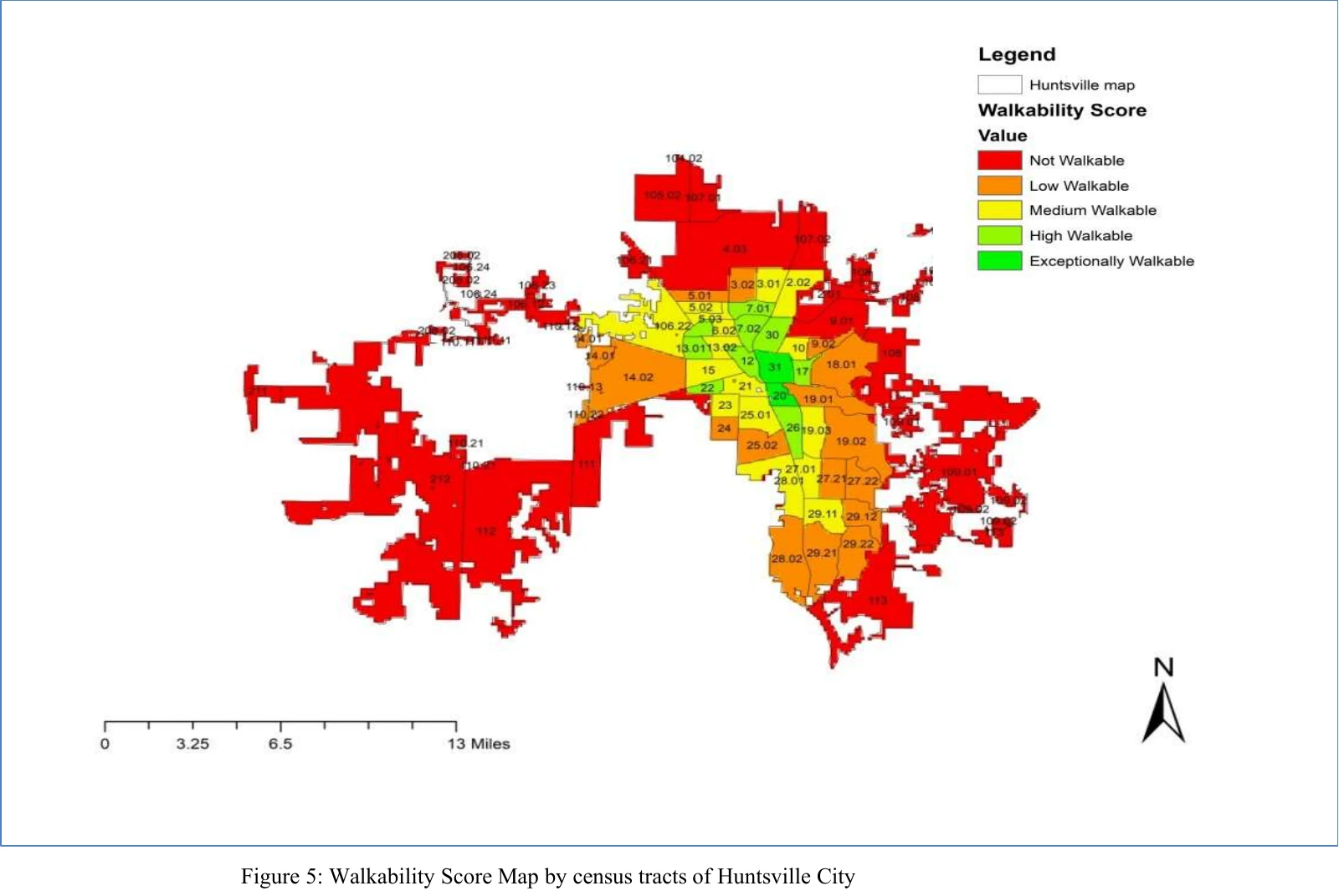
Final walkability score map from the graduate thesis, with the original legend and scale.
How does walkable access vary across neighborhoods and demographic conditions?
- Developed a Walkable Service Area Analysis model with ArcGIS Network Analyst.
- Compared network access to destinations with demographic and land-cover conditions.
- Examined how density, poverty, and development intensity relate to accessibility.
The study classified 64.82% of the study area as not or low walkable and 13.17% as highly walkable, revealing uneven access across neighborhoods.
Conference presentation
National Association of African American Studies & Affiliates National Conference · February 21, 2020
Supporting documents
Acceptance & invitation letter
The organizer’s letter, dated October 24, 2019, accepts this paper and schedules a 25-minute presentation for February 21, 2020 at 2:00 PM.
A GIS-Based Walkable Service Area Analysis (WSAA) Model for Assessment of Spatial Accessibility Equity: A Case Study in Huntsville, Alabama
Master’s thesis · PDF · 81 pages · 1.5 MB