Planning / Academic research
Better access to sheltered transit
Using network analysis to evaluate sheltered bus-stop locations and population coverage.
- Year
- 2024
- Project type
- Graduate course project
- My role
- Network analysis & site selection
Spring 2024 · GEOG 5366: Cartography and Visualization · SHSU
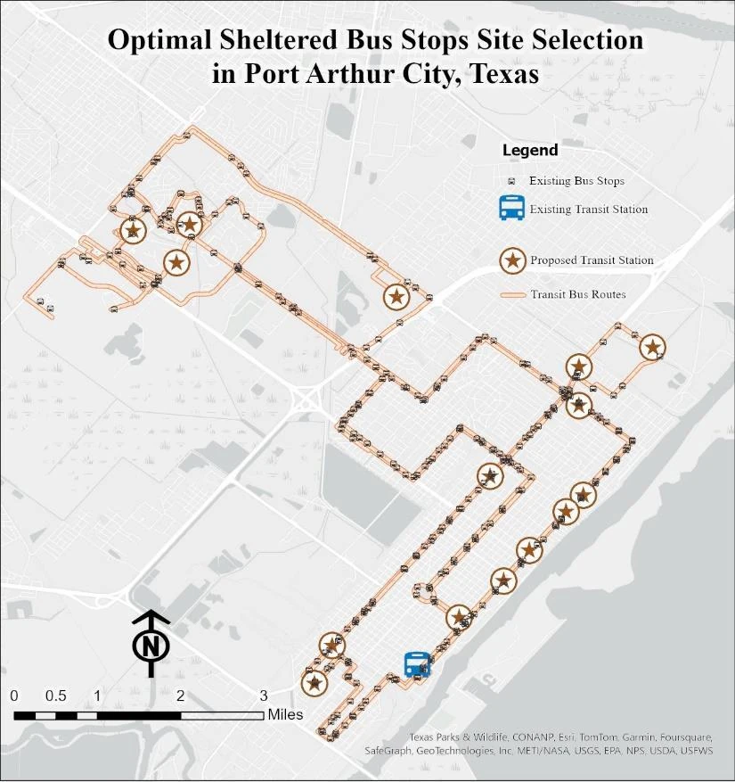
Final location-allocation map showing existing and proposed sheltered stops.
Where could sheltered bus stops improve practical access to public transportation?
- Connected census-block centroids and demographic attributes to a pedestrian street network.
- Evaluated origin–destination walking distances and access within a 400-meter threshold.
- Applied a network-ratio method to relate accessible street length to population coverage.
The study proposed a minimum set of 15 sheltered transit stations to improve population coverage along the existing bus routes.
Location-Allocation Model-Based Approach for Sheltered Bus Stops Site Selection in Port Arthur City, Texas
Research poster · PDF · 1 page · 690 KB