Environment / Academic research
Environmental sensitivity around energy infrastructure
Weighted overlay and spatial statistics connecting hydrography, land cover, and population.
- Year
- 2024
- Project type
- Graduate course project
- My role
- Spatial analysis & cartography
Fall 2024 · GEOG 5075: Real-World Problem-Solving with Geospatial Analysis · SHSU
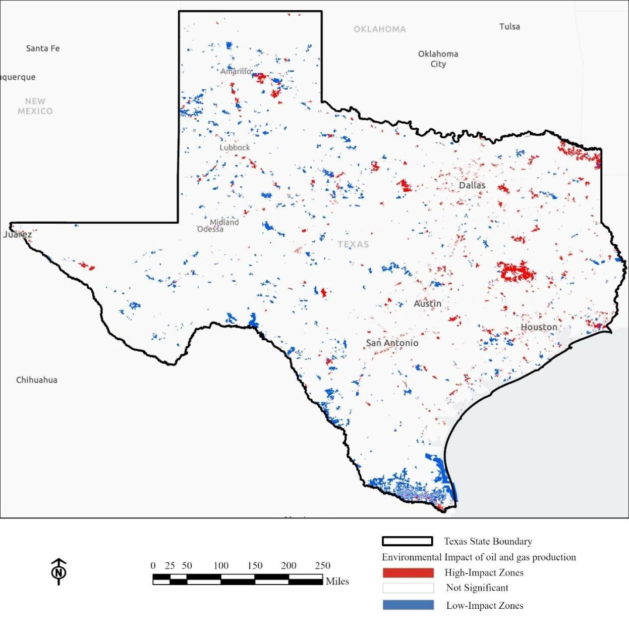
Original screening map of high, low, and statistically non-significant impact zones. The analysis does not establish environmental causation.
Where do environmental and community sensitivities overlap with oil and gas production?
- Combined half-mile well buffers with NHD hydrography, NLCD land cover, and census population.
- Applied a weighted overlay: hydrography 40%, land cover 30%, and population 30%.
- Used zonal statistics and Optimized Hot Spot Analysis to compare spatial concentrations.
The study identified concentrated sensitivity around major urban areas and Gulf Coast wetlands, supporting a place-based screening discussion.
Spatial Analysis of Oil and Gas Production Impact on Surrounding Environment in Texas
Final report · PDF · 19 pages · 748 KB