Remote sensing / Academic research
Understanding the urban canopy
A LiDAR vegetation study mapping canopy intensity across 173.28 square kilometers.
- Year
- 2024
- Project type
- Graduate course project
- My role
- LiDAR analysis & cartography
Fall 2024 · GEOG 5075: Novel Remote Sensing and Geospatial Applications · SHSU
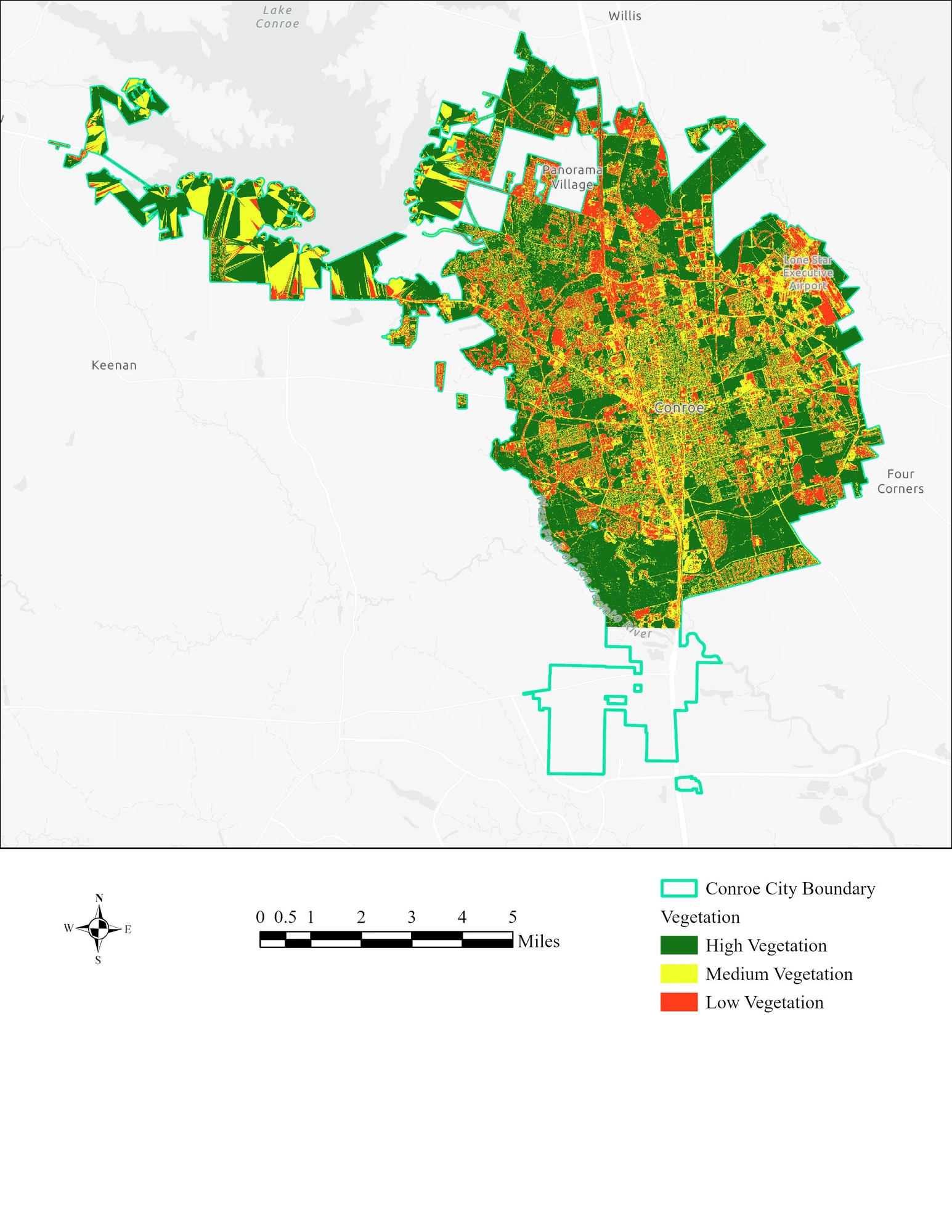
Original vegetation intensity map showing high, medium, and low vegetation zones.
How does vegetation intensity change between the urban core and the surrounding landscape?
- Used LAS vegetation classes and 10-meter analysis cells.
- Created an intensity raster and classified vegetation with Jenks natural breaks.
- Compared mapped patterns with aerial imagery.
Dense or high vegetation occupied 51.68% of the study area and medium vegetation 29.78%, with lower vegetation in the urban core and stronger canopy toward the periphery.
Vegetation Canopy and Green Space Analysis Using LiDAR Data in Conroe, TX
Final report · PDF · 15 pages · 2.0 MB